Up to 837.7 hectares on the Monaro high plains
Eleven lots of predominantly open grazing country with direct frontage to the Monaro Highway, approximately 10 km south of Cooma, at roughly 900 m elevation.
7845 Monaro Highway, Rock Flat NSW 2630 · 36.283683° S, 149.164984° E Open in Google Maps (opens in a new tab)
Room to build an energy ecosystem around the compute
Land area at this scale is not primarily about the footprint of the data halls. It is about being able to build utility-scale solar, battery storage, dedicated substations, gas firming plant, security setbacks, pipeline and transmission easement corridors, construction laydown and staged expansion on the same title, without any of those elements competing with each other for space. That is a configuration a constrained metropolitan site cannot easily reproduce, and it is what turns a landholding into a precinct.
- Data halls in stages
- A second campus
- Substations and switching
- Utility-scale solar
- Battery storage
- Cooling and water infrastructure
- Setbacks from the corridors and the highway
- Buffers to neighbours
- Construction compounds and laydown
- Expansion over time
What the scale allows to be designed together. The developable footprint for each is still to be established.
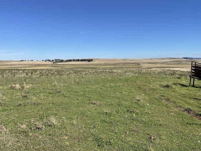
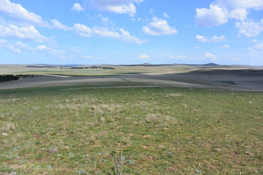
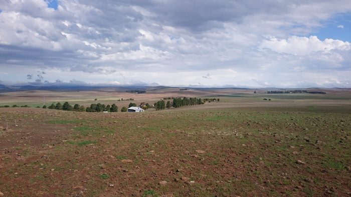
Site photographs, undated. Indicative of character and topography only; they do not establish boundaries, developable area or ground conditions.
The infrastructure is marked on the ground by its owners
A second inspection walked the fence lines. Three asset owners have posted their own signage on the holding: Telstra for an optical fibre cable, Jemena for the Eastern Gas Pipeline, and Essential Energy on the 132 kV structures. That is a different grade of evidence from a utility location response: the owner, in the field, saying the asset is here.
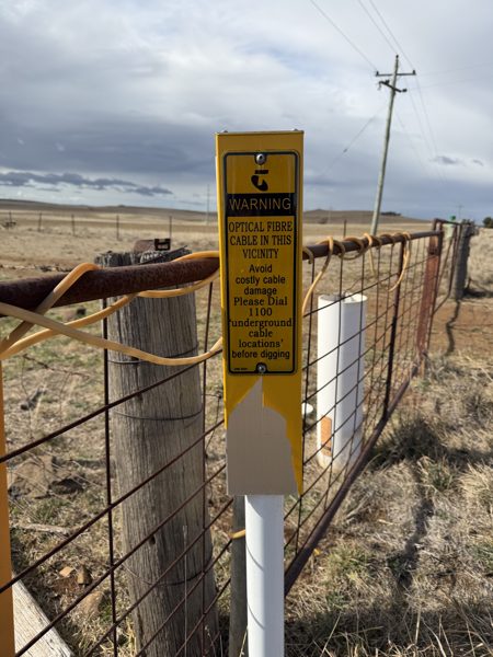
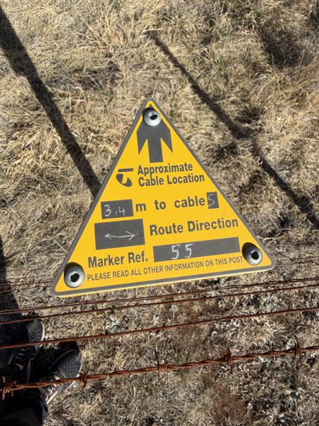
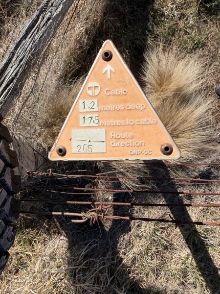
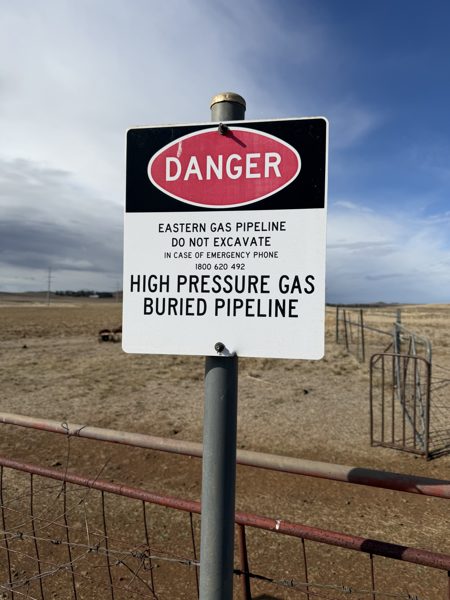
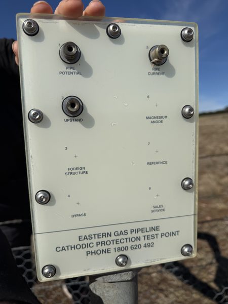
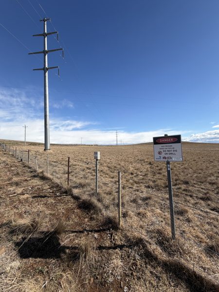
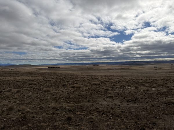
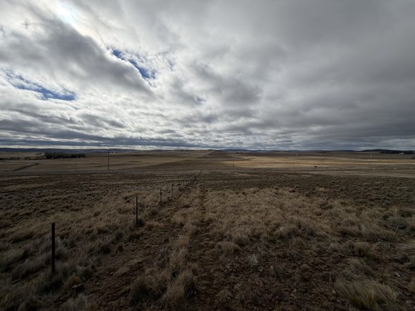
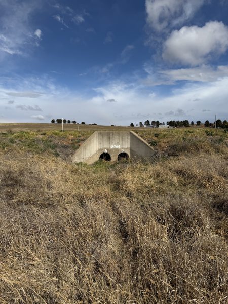
Photographs taken 5 and 6 September 2026 and reproduced without alteration other than cropping and resizing. Marker positions are on the holding’s fence lines and have not been surveyed; the exported photographs carry no GPS record. Signage confirms the presence and ownership of an asset. It does not establish fibre capacity, route role or diversity, gas pressure or offtake capacity, or electrical capacity. The full record is in Appendix A of the executive summary.
Three energy corridors in one lot, fibre and the highway through the middle
The Eastern Gas Pipeline, a 66 kV line and the 132 kV feeder all cross Lot 1 DP500662 on the eastern side of the holding, and no other lot. The Monaro Highway, and the indicative data and fibre corridor along it, run through the middle. That leaves roughly 642 hectares of the supplied lots clear of all three energy corridors. The key facts, as they appear on the plan →
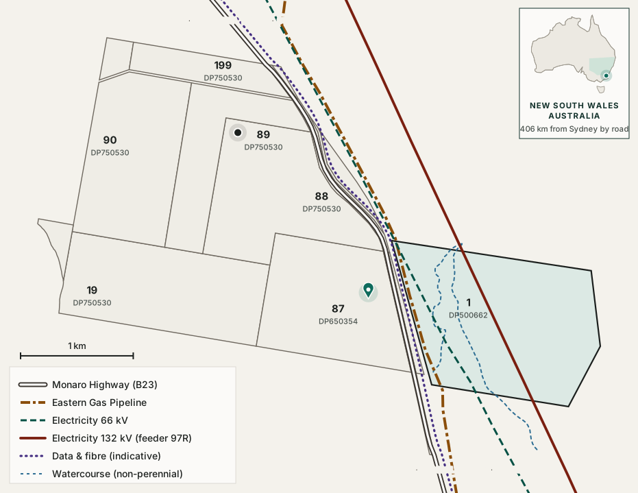 Open the interactive plan
See it for yourself on the interactive map
Switch layers on and off, select any lot or line to see what it is and why it matters, and view the photographs taken on the ground at each one.
Open the interactive mapDrawn from NSW MinView vector exports of 27 August 2026 and the supplied lot plan. Indicative only, not a survey. Lot areas and the total do not yet reconcile with the commercial property data used elsewhere on this site; the interactive plan sets out the difference.
The specification
| Item | Detail |
|---|---|
| Address | 7845 Monaro Highway, Rock Flat NSW 2630 |
| Coordinates | 36.283683° S, 149.164984° E |
| Approximate area | Up to 837.7 ha (lots as supplied, including 17.9 ha of road reserve; title survey required) |
| Constituent lots | 11 lots as supplied: 1/DP500662, 19/DP750530, 90/DP750530, 87/DP650354, 88/DP750530, 89/DP750530, 199/DP750530, 7101/DP1140426, 2/DP241234, B/DP358043, 3/DP241234 |
| Council | Snowy Monaro Regional Council |
| Regional plan | South East and Tablelands |
| Zoning | RU1 Primary Production see Planning |
| Height of building | 9 m |
| Minimum lot size | 400 ha and 80 ha |
| Elevation | About 850 to 900 m across the holding (1:25,000 topographic sheet, with spot heights of 887 to 936 m; a commercial dataset records 903 m. To be verified by survey) |
| Topography | Predominantly open grazing land, low existing building coverage |
| Bushfire | Mapped as bushfire prone land in the vegetation category (NSW Planning Portal property report). The holding is open grassland with negligible tree cover; a bushfire assessment is a feasibility item |
| Road access | Monaro Highway, route B23, classified State road HW19. Reserve runs approximately 3.9 km through the holding see Access |
| Electricity | Essential Energy 132 kV feeder 97R crosses the holding see Power |
| Gas | Jemena Eastern Gas Pipeline, EGP Midline see Energy |
| Telecommunications | Telstra major cable and optic fibre indication, plus NBN assets see Connectivity |
| Aboriginal Land Council | Merrimans LALC |
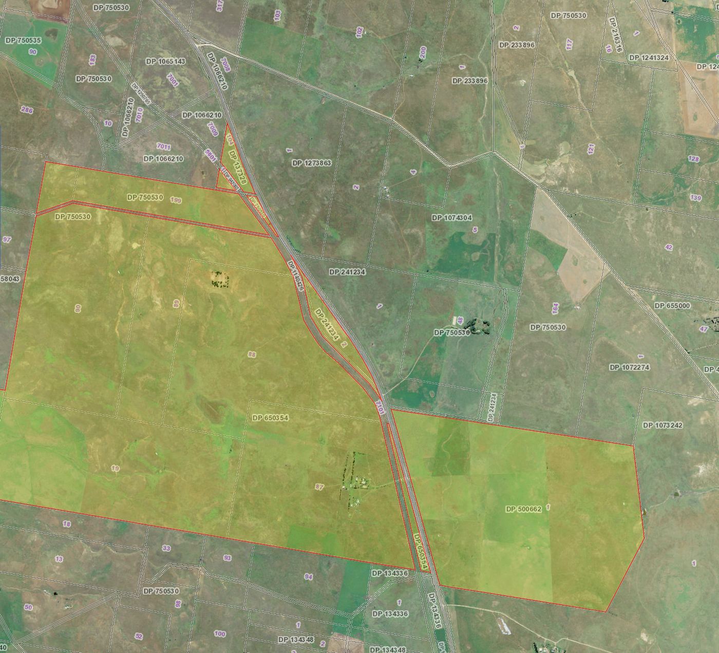
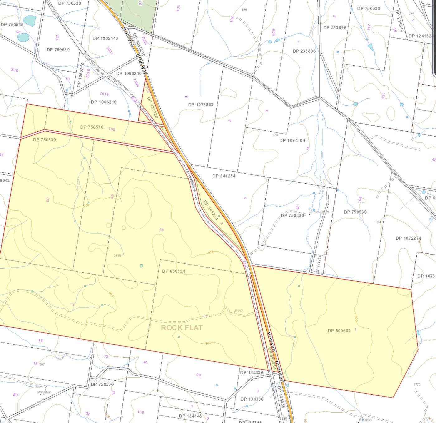
The 837.7 ha figure is the total of the eleven lot polygons as supplied, stated as an upper bound; it includes 17.9 ha of Monaro Highway road reserve and is not a title or survey area. The elevation derives from commercial property data. A consolidated title, easement and area schedule across all lots is a first-order item for the next stage, because pipeline and transmission easements will directly constrain the developable footprint.
Regional scale with east-coast access
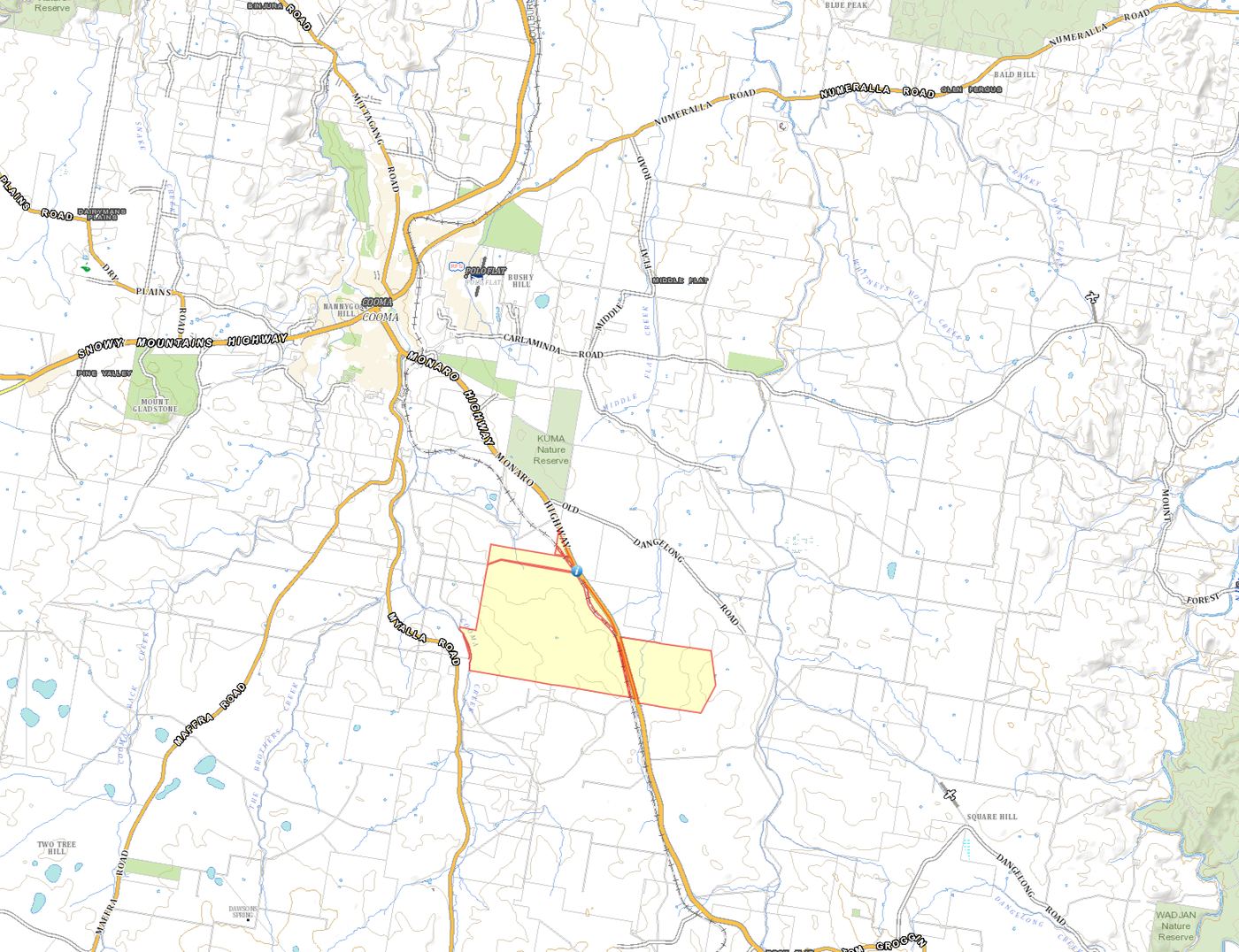
Rock Flat is in south-eastern Australia, in the state of New South Wales, immediately south of the town of Cooma with direct Monaro Highway access. Its regional location could provide an alternative to increasingly constrained metropolitan data centre precincts while maintaining access to Canberra and major east-coast markets.
- Cooma~10 km
- Canberra~126 km
- Sydney~406 km
- Melbourne~630 km
All distances indicative.
A State highway to the boundary
The Monaro Highway, route B23, runs through the holding for approximately 3.9 km. Transport for NSW classifies it as State road HW19 and manages and funds it for its full 205 km New South Wales length.
That matters more than it first sounds. A data centre build is an oversize and overmass transport problem before it is anything else: transformers, switchgear and standby generators arrive as single indivisible loads that need permits, defined turning geometry and a reinforced haul route. Arriving on a State-managed highway rather than a council road removes a category of access risk that constrains many regional sites.
| Destination | By road | Typical drive | Route and relevance |
|---|---|---|---|
| Cooma | 10 km | 9 min | Monaro Highway B23. Regional centre, workforce, accommodation and services |
| Canberra | 126 km | 1 h 30 | Monaro Highway B23 the whole way. An established, and now constrained, data centre market |
| Canberra Airport | ~125 km | 1 h 30 | Scheduled passenger services and international freight handling, and no curfew |
| Sydney | ~406 km | 4 h 30 | Monaro, Federal and Hume M31 |
| Melbourne | ~630 km | 7 h 45 | Monaro and Princes highways via Cann River |
| Bega and the far south coast | ~119 km | 1 h 30 | Snowy Mountains Highway B72 over Brown Mountain |
| Port of Eden | ~173 km | 2 h 20 | Via Bega, then Princes Highway A1 |
| Jindabyne | ~68 km | 50 min | Snowy Mountains region |
All road distances are measured from the site at 7845 Monaro Highway, rounded. Drive times are typical for a car in normal conditions; heavy and oversize vehicles will take longer.
A Snowy 2.0 transport plan records the Monaro Highway as generally an approved 25 to 26 metre B-double route apart from a section inside Cooma, between Murray Street and the Snowy Mountains Highway. Whether that exclusion affects a northbound movement from Rock Flat needs checking against the National Heavy Vehicle Regulator network map. Road train access has not been established and should not be assumed. Site access geometry onto a classified road requires Transport for NSW agreement, and the property report records a 1.5 m classified road buffer.
Both governments are currently investing in this corridor. The Australian Capital Territory (ACT) has a $260.5 million Monaro Highway upgrade explicitly aimed at freight efficiency for southern New South Wales, and Transport for NSW has a safety and efficiency programme that includes works between Rock Flat and Nimmitabel.
Cooma–Snowy Mountains Airport, about 15 km from town, has a sealed 2,120 m runway and serves aeromedical and general aviation, but its operator states that no airlines currently fly there. It should be read as a charter and aeromedical asset, not a passenger connection.
A cool, dry, elevated location
The average daily peak barely reaches the threshold at which economiser cooling typically becomes ineffective, so the great majority of annual hours sit below it.
That directionally supports a design philosophy built around air cooling, free cooling, closed loop systems and low water usage effectiveness. A specific annual hour count below a given dry bulb threshold has deliberately not been stated: the Bureau of Meteorology does not publish that statistic, and it must be derived from hourly observations or a typical meteorological year file before it appears in any technical document.
The NSW Data Centre Guidelines treat a low water design as the preferred outcome rather than a fallback. Water-intensive cooling must run on recycled water, and “there must be no adverse impact on agricultural water use in agricultural areas”, which is what RU1 land in the Monaro is. Where recycled water is not available, and there is no recycled network here, the Guidelines accept closed-loop systems instead. Their efficiency measure pairs a water usage effectiveness of 0.44 or better with a design PUE of 1.3 or better; the tighter pairing is a PUE of 1.25 with a WUE of 1.0.
The intent for this site is therefore a closed loop, air-cooled architecture with a design PUE target in the cool-climate band, and water treated as a construction and amenities requirement rather than a cooling one. That is a design position, not a completed study. The architecture, and the demand that falls out of it, still have to be engineered, and the hourly climate analysis noted above has not been done.
A second design principle sits beside the low-water aspiration: no routine diesel storage on site. The Eastern Gas Pipeline crossing Lot 1 creates the opportunity to investigate gas-supported resilience and emergency generation in place of the diesel farms that back up a conventional campus. Whether it can, and on what terms, is for Jemena and the energy engineers; the principle is stated so that feasibility tests it.
Designed for a low-water future
Water is the least resolved item on this site, and the reason to design differently. The aspiration is a precinct that avoids routine reliance on potable town water for cooling: closed-loop and hybrid systems that need little water, and non-potable sources, captured rainwater or recycled water, for what they need. No water supply or cooling solution has been secured.
Infrastructure Australia publishes indicative annual water requirements for data centres by size, derived from Water Services Association of Australia data:
| Facility | Indicative annual water requirement |
|---|---|
| Small, 25 MW | 0.09 to 0.66 GL per year |
| Average, 100 MW | 0.35 to 2.2 GL per year |
| Hyperscale, 250 MW | 0.88 to 5.5 GL per year |
The width of those ranges is the important feature. The upper bound is roughly seven times the lower bound at every size, and the difference is cooling technology, not scale. That should not automatically become this project's water requirement. The feasibility study should investigate both sides of the equation: what supply is actually available, and what minimum demand an optimised Monaro cooling architecture could achieve. NSW also has an IPART review of water pricing for data centres underway as part of the August 2026 policy framework.
Essential Energy's Before You Dig response returned no reticulated water or sewer asset in the search area. No large-scale water supply has been demonstrated at this site. The water and cooling questions in the FAQ →
Now the largest unresolved infrastructure question
Against the NSW Data Centre Guidelines, water ranks ahead of gas in the feasibility priority list. Three performance measures bear on it. For water-intensive cooling, measure 2 expects 100% recycled water or a formal utility agreement for the transition to rainfall-independent supply, with no adverse impact on agricultural water use. Measure 3 requires the ability to reduce consumption during drought while any potable interim supply is used. Where recycled water is unavailable, as it is here, measure 14 requires the developer to negotiate a plan with the utility to fully offset potable use, through funded additional supply, efficiency programs or closed loop systems.
The concept for this site should therefore begin with closed loop, low water or hybrid cooling as the base case, rather than assume conventional evaporative cooling and go looking for the water to run it. That turns what first looks like a water constraint into an environmental selling point, and it is the design position recorded under climate. It remains a position rather than a study until the cooling architecture is engineered.
| What feasibility must establish | Why |
|---|---|
| Cooling strategy | Dry, hybrid or closed loop. Decides whether measure 2 applies at all, and sets the demand every other water question depends on |
| Water source and capacity | Construction, amenities and any make-up water. No reticulated supply is identified in the search area |
| Rainfall-independent solution | Measure 14. Closed loop cooling, new infrastructure, or a funded offset with the utility |
| Drought resilience | Measure 3. A design that can reduce draw on restriction without curtailing compute |
| Utility agreement | Measure 11. A water servicing agreement that protects other consumers from infrastructure cost, or a design that makes one unnecessary |
| Target dPUE and dWUE | Measure 1. The cool climate may support dPUE ≤1.3 with dWUE ≤0.44, but the hourly analysis has not been done |
What rarely sits on one holding, and what each fact does not yet establish
- Land
- up to 837.7 haAbout 2,070 acres across 11 lots as supplied. Room to investigate data halls, solar, storage and setbacks; the developable footprint is still to be established. The site →
- Scale
- 50 to 300 MWThe scale of data centre development being investigated, in stages. Not confirmed grid capacity. The opportunity →
- Electricity
- 132 + 66 kVBoth lines cross the holding on Lot 1, and regional wind already exports on the 132 kV. Available capacity is untested. Power →
- Gas
- Eastern Gas PipelineHigh pressure transmission main crosses Lot 1, confirmed present by Jemena. Pressure, offtake and terms are for Jemena to answer. Energy →
- Data and connectivity
- Optical fibre at the boundaryTelstra’s own fibre markers on the fence line, and an NBN asset identified. Capacity, diversity and carrier options to establish. Connectivity →
- Water
- Designed for low waterA cool climate at about 900 m may support closed loop or hybrid cooling. No supply has been demonstrated. Water →
- Location
- 10 km to CoomaA town of about 6,700 people, none of it within 4 km: potential access to workforce and services with separation from residential areas. Canberra 126 km, Sydney 406 km, Melbourne 630 km by road. Distance from Cooma →
- Renewables
- Wind on the line, solar to investigateBoco Rock wind exports on feeder 97R today. On-site solar and storage are opportunities to investigate; no supply is committed to this site. Energy →
Presence and position only. No electrical capacity, gas capacity, telecommunications service, water supply or planning approval is claimed, secured or offered.
Move from opportunity to feasibility
Rock Flat is seeking engagement with experienced digital infrastructure, energy and investment partners to undertake the next stage of technical and commercial feasibility. Detailed title, infrastructure, utility and commercial information is available to qualified parties.